(This is an archived page about the total solar eclipse that occurred on April 8, 2024. For information on future eclipses, please see our Upcoming Eclipse Maps page.)
On April 8, 2024, a total solar eclipse will carve a narrow path of totality from southwest to northeast across 13 U.S. states. To experience the total phase of the eclipse, you must be located within this narrow path of totality, with the duration of totality lasting the longest at the centerline. But where along the path should you plan to go? Below, we've outlined some of the unique features, landmarks, and viewing options along the path of totality for each state.
Remember that you must use special eclipse safety glasses or viewers at all times during the partial phases of a total solar eclipse. The NationalEclipse.com Eclipse Store offers a wide variety of certified safe eclipse glasses and viewers.
Note that times and durations can vary widely even within the same city and some cities are located only partially within the path of totality. All times and durations noted on this page are only representative samples and should be used for general comparison purposes only.
To avoid confusion, note that references made below to the "western" and "eastern" limits or lines of the eclipse refer respectively to the left/top and right/bottom edges of the eclipse path as it gradually changes its direction from north to east as it travels across the U.S.
The centerline of the eclipse enters Texas, and the U.S., as it crosses the Rio Grande River at the Mexico-U.S. border at approximately 12:10pm CDT, with totality beginning in that location at about 1:27pm CDT.
As it exits Mexico and enters the U.S., traveling through the Texas Hill Country, the eclipse will have already reached its "point of greatest duration," that singular spot along every total solar eclipse centerline where the duration of totality is longer than anywhere else. That point is also the duration of totality "tipping point," meaning that the duration gradually increases along the centerline up until that point and then starts to decrease on the other side. In other words, for the 2024 eclipse, the duration of totality is all downhill in the U.S., with the longest durations in Texas and the shortest in Maine. Therefore, the path of totality in Texas will be considered a prime viewing destination on April 8. And since the point of greatest duration in Mexico is only a little more than 300 miles to the south of where the path of totality enters the U.S., the duration of totality on the centerline will only be a few seconds short of the eclipse maximum of 4 minutes and 28 seconds even a couple of hundred miles north of the border.
If the longest durations of totality in the U.S. wasn't enough, Texas is also widely considered to have the best eclipse-day weather prospects in the country. More specifically, eclipse weather forecasting site eclipsophile.com points out that, in Texas, "the north [or west] side of the track has a notably sunnier April climate than the south [or east]." In general, the farther south you are for this eclipse, the better your weather odds. And you can't get any farther south along the path of totality in the U.S. than Texas.

Texas will also be the place where perhaps more people will witness totality than anywhere else in the U.S., not only because Texas is such a large state and the path of totality covers so much ground here, but also because Texas is where the path happens to cross the three largest cities—San Antonio, Dallas, and Austin—it will encounter during its journey across the country. In fact, not long after the eclipse enters the U.S., the 120-mile-wide path of totality crosses over the most populous city along its path in the U.S. Unfortunately, though, San Antonio sits right on the eastern edge of the path of totality with about half of the city inside the path and half outside. Downtown attractions like the River Walk and the Alamo are outside the path of totality and you'll need to be in the northwestern part of the city to see a total eclipse—although totality durations will be relatively short here along the edge of the path. If you're at SeaWorld San Antonio, for example, you'll witness totality for about 2 minutes and 3 seconds, with the duration steadily decreasing to the south and east. If you're in the San Antonio area and want to more than double your totality viewing time, drive west on Interstate 10 to reach the eclipse centerline about 60 miles away.
Just a bit farther north, the eclipse crosses over the Texas state capital, Austin. As with San Antonio, Austin lies along the eastern edge of the eclipse path where durations of totality will be relatively short. Luckily, though, totality will be seen within most of Austin's city limits, with just a few areas in the southeastern part of the city outside the path. Downtown Austin will get about 1 minute and 44 seconds of totality, with durations dropping off as you go south and east. By early April, Austin's famous Congress Avenue Bridge bats should have arrived from their winter grounds in Mexico. It will be an interesting experiment in animal behavior to see if the bats emerge from under the bridge during the eclipse.

The sprawling Dallas-Fort Worth Metroplex area spreads out from the western limit of the eclipse path all the way to the centerline, offering residents and visitors plenty of places to view totality. For the cities themselves, Dallas is centered about halfway between the centerline and the western limit of the eclipse path while Fort Worth is closer to the western edge. In downtown Dallas, you'll enjoy about 3 minutes and 51 seconds of totality. Fort Worth will get about 2 minutes and 33 seconds of totality downtown, with durations decreasing as you go north and west and with a few areas outside the path of totality in the far northwestern part of the city. On the other, less heavily populated, side of the centerline from the Dallas-Fort Worth area, interstates 45, 20, and 30 can be used to reach the maximum durations found near the centerline. Houston is relatively close on the eastern side of the eclipse path. Drive west on I-10 to reach the path in under three hours or north on I-45 to reach totality in under two. Shreveport, Louisiana, is within easy striking distance via Interstate 49 or I-20 and can make a good basecamp for eclipse expeditions.
The centerline of the eclipse exits the state as it crosses the Red River at approximately 3:06pm CDT, with totality coming to an end in that location at about 1:49pm CDT. From the Mexico-Texas border to the Texas-Oklahoma border, the Moon's shadow travels approximately 478 miles along the centerline in 17 minutes and 29 seconds at an average speed of 1,641 miles per hour.
(hover or tap to see points of interest in Texas)

The centerline of the eclipse enters Oklahoma as it crosses the Red River at approximately 12:27pm CDT, with totality beginning in that location at about 1:45pm CDT.
The path of the eclipse through Oklahoma is a relatively brief affair as it skims the southeastern corner of the state. The centerline travels through Oklahoma for a mere 31 miles, the shortest distance of any state through which the centerline travels, and the eastern line of the eclipse path never even makes it into the state.
In Oklahoma, the path never crosses a town with a population of at least 10,000 people. The most populated town over which the eclipse travels in Oklahoma is probably Poteau. Poteau, however, sits right along the western edge of the path, with totality lasting for only about 1 minute and 22 seconds in the middle of town. Durations drop off quickly as you go north and west and some northern neighborhoods are outside the path of totality.
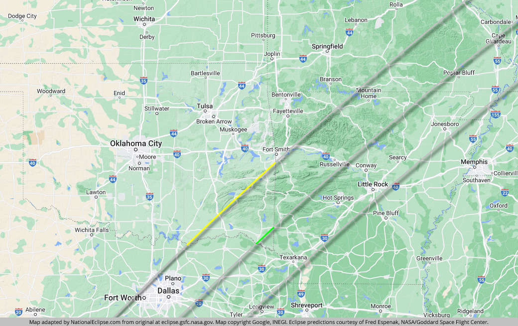
Although Oklahoma City is well outside the eclipse path, you can easily reach totality with a day trip to the south or east. Driving south on Interstate 35 will get you to the path of totality in Texas while driving east on Interstate 40 will get you to totality in Arkansas.
The centerline of the eclipse exits the state at approximately 3:07pm CDT, with totality coming to an end in that location at about 1:50pm CDT. From the Texas-Oklahoma border to the Oklahoma-Arkansas border, the Moon's shadow travels approximately 31 miles along the centerline in 1 minute and 5 seconds at an average speed of 1,719 miles per hour.
(hover or tap to see points of interest in Oklahoma)
The centerline of the eclipse enters Arkansas at approximately 12:29pm CDT, with totality beginning in that location at about 1:46pm CDT.
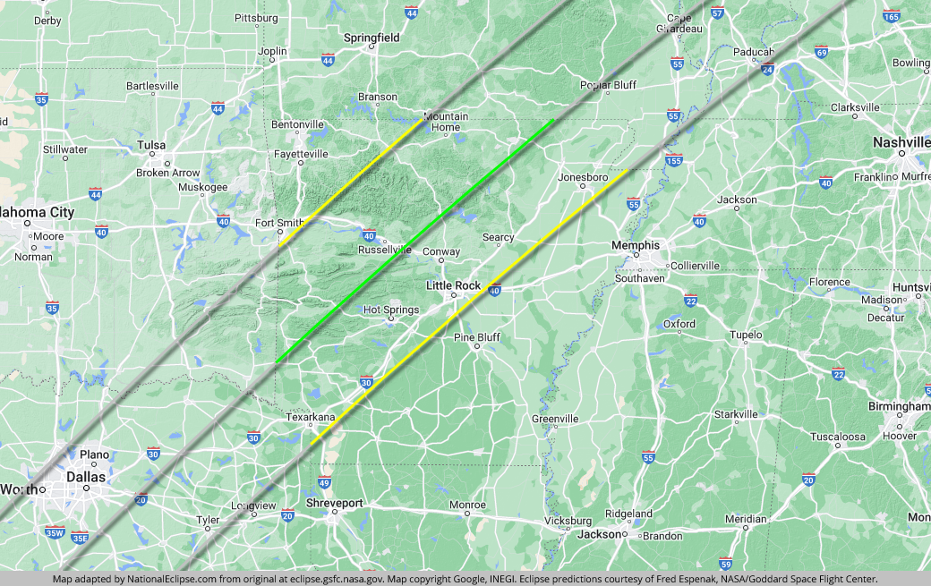
The centerline cuts across Ouachita National Forest, offering plenty of places to see long durations of totality in a natural setting. On the western side of the path, the eclipse crosses over much of Ozark National Forest. Both of these areas will make for scenic eclipse viewing if you can find a clear view of the sky free of trees. However, as is the case with all mountainous regions, the high elevations could result in the formation of clouds over the Ouachita and Ozark mountains that might pose a problem on eclipse day. Make sure to check short-term weather forecasts for the region in the days leading up to the eclipse.
About halfway between the centerline and the eastern edge of the eclipse path is Hot Springs National Park, one of only two U.S. national parks located along the path of totality. This unique distinction, along with relatively long totality durations and the tourist amenities offered by the adjacent historic resort city of Hot Springs, will make this area a popular viewing destination on April 8. Totality will last for about 3 minutes and 37 seconds in downtown Hot Springs.

Conway is also located between the centerline and the eastern edge of the eclipse path, closer to the former rather than the latter, with totality lasting for about 3 minutes and 53 seconds downtown. Below Conway and closer to the eastern limit of the path is the Arkansas state capital, Little Rock, where observers can expect about 2 minutes and 20 seconds of daytime darkness in the downtown area—a duration that's considered merely respectable for the 2024 eclipse. Interstate 40, which runs through both Little Rock and Conway, bisects the entire path of totality, providing easy access to maximum durations on or near the centerline.
In the northeastern corner of the state, Jonesboro is located fairly close to the eastern edge of the path, with totality lasting for about 2 minutes and 21 seconds in the downtown area. Although Memphis isn't located in the path of totality, it's close enough on the eastern side to serve as a fun base of operations for eclipse chasers. On eclipse day, just cross the Mississippi River into Arkansas and take Interstate 55 and then Interstate 555 into the path of totality in the vicinity of Jonesboro. Branson, Missouri, is another fun city that doesn't quite make the totality cut but is close enough to make a great basecamp. On the western side of the eclipse path, it's less than an hour away.
The centerline of the eclipse exits the state at approximately 3:14pm CDT, with totality coming to an end in that location at about 1:59pm CDT. From the Oklahoma-Arkansas border to the Arkansas-Missouri border, the Moon's shadow travels approximately 257 miles along the centerline in 8 minutes and 44 seconds at an average speed of 1,763 miles per hour.
(hover or tap to see points of interest in Arkansas)
The centerline of the eclipse enters Missouri at approximately 12:38pm CDT, with totality beginning in that location at about 1:54pm CDT.
Missouri is the first state along the path of the 2024 eclipse that was also along the path of the 2017 eclipse. But unlike in 2017, when large cities like Kansas City and St. Louis experienced totality as the eclipse swept across the width of the state, the 2024 eclipse misses any major population centers in its journey through the southeastern corner of Missouri.
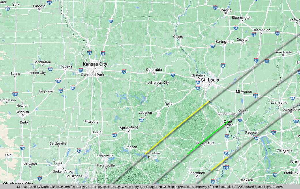
Along the western portion of the eclipse path in Missouri, totality will be seen in several districts of Mark Twain National Forest and the centerline travels through a small section of the preserve. Running roughly parallel to the Mississippi River, Interstate 55 cuts across the entire width of the eclipse path, providing easy access to the centerline for Missourians residing along the western banks of the river. Cape Girardeau, the largest city with a ticket to the totality party in Missouri, is located very close to the eclipse centerline. In the downtown area, the duration of totality breaks the 4-minute mark at about 4 minutes and 6 seconds. Cape Girardeau was also in the path of the historic 2017 total solar eclipse, but with a totality duration that clocked in at less than 2 minutes back then, the 2024 edition promises to delight the city for over twice as long.
St. Louis sat right on the edge of totality in 2017, with half of the city inside the eclipse path and half outside. In 2024, St. Louis misses out completely, but the city is still close enough that eclipse chasers can reach the path in less than an hour. On eclipse day, drive south on I-55 or east on Interstate 64 in Illinois. Both routes will take you into the path and eventually to the centerline.
The centerline of the eclipse exits the state as it crosses the Mississippi River at approximately 3:17pm CDT, with totality coming to an end in that location at about 2:02pm CDT. From the Arkansas-Missouri border to the Missouri-Illinois border, the Moon's shadow travels approximately 110 miles along the centerline in 3 minutes and 39 seconds at an average speed of 1,813 miles per hour.
(hover or tap to see points of interest in Missouri)
The centerline of the eclipse enters Illinois as it crosses the Mississippi River at approximately 12:42pm CDT, with totality beginning in that location at about 1:58pm CDT.
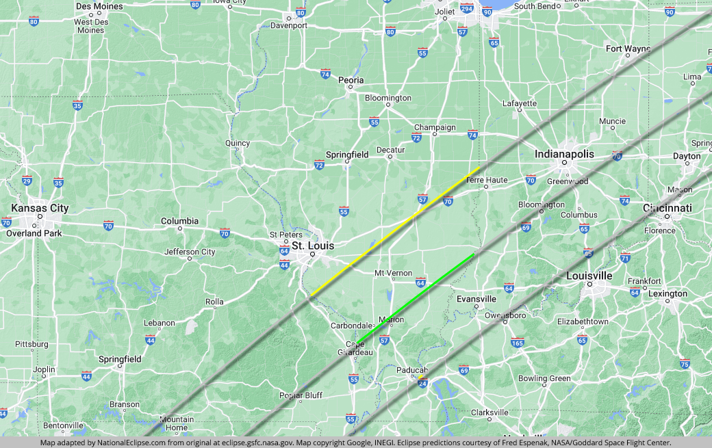
Illinois, or more specifically, Southern Illinois, was a hotspot of the 2017 eclipse because it was the site of the "point of greatest duration." At no other point along the eclipse path was the duration of totality longer than it was at that singular spot on the centerline in Southern Illinois. In 2024, the point of greatest duration is in Mexico, but Southern Illinois still holds an interesting distinction in 2024 that will make it an attractive destination for eclipsophiles. In the lead-up to the 2017 eclipse, Southern Illinois was touted as the "Eclipse Crossroads of America" because it also happened to be the place where the centerline of the 2017 eclipse would cross the future centerline of the 2024 eclipse. While the exact spot where the two centerlines meet is located near the town of Makanda, the full widths of the two paths create a zone of overlapping totality of almost 9,000 square miles spanning parts of Missouri, Illinois, and Kentucky. Conceivably, someone who saw totality here in 2017 could see two total solar eclipses from the exact same spot in the span of only seven years.
Aside from the astronomical trivia, the path of the eclipse through Illinois is a relatively short and unremarkable one (if you could call any aspect of a total solar eclipse "unremarkable"). Carbondale, although a relatively small city, happens to be the largest city along the eclipse path in Illinois. Sitting almost directly on the eclipse centerline, totality will last for about 4 minutes and 8 seconds in downtown Carbondale, only 19 seconds short of the eclipse maximum in the U.S. Such a long duration of totality almost seems like compensation for Carbondale; in 2017, the city would have experienced about 2 minutes and 37 seconds of totality, one of the longest durations in the country, if clouds hadn't spoiled the show for many observers. Besides the 4-minute-plus duration, Carbondale is also located not far from the exact spot where the 2017 and 2024 centerlines meet, which will make the city an attractive destination for eclipse die-hards who want to stake a claim to seeing the eclipse near that spot or even try to find that exact spot on eclipse day.
All of Shawnee National Forest is within the path of totality and the centerline runs through it. Interstate 57 runs down from the western limit of the eclipse path and up from the southern tip of the state to the centerline and Interstate 24 comes up from the eastern limit of the eclipse path in Kentucky to meet I-57. Interstate 64 crosses the entire path of totality in Illinois. St. Louis is close to the path on the western side and can serve as a convenient basecamp. Driving east on I-64 will get you to totality in less than an hour.
The centerline of the eclipse exits the state as it crosses the Wabash River at approximately 3:20pm CDT, with totality coming to an end in that location at about 2:06pm CDT. From the Missouri-Illinois border to the Illinois-Indiana border, the Moon's shadow travels approximately 129 miles along the centerline in 4 minutes and 19 seconds at an average speed of 1,787 miles per hour.
(hover or tap to see points of interest in Illinois)
Kentucky is sort of an oddball of the 2024 eclipse. On April 8, only the eastern line of the eclipse path makes it into the Bluegrass State. It scrapes along the northwestern edge of the state, capturing several small areas inside the path as the state line formed by the Mississippi and Ohio rivers meanders back and forth across the totality line. The western line and the centerline of the eclipse bypass the state completely.
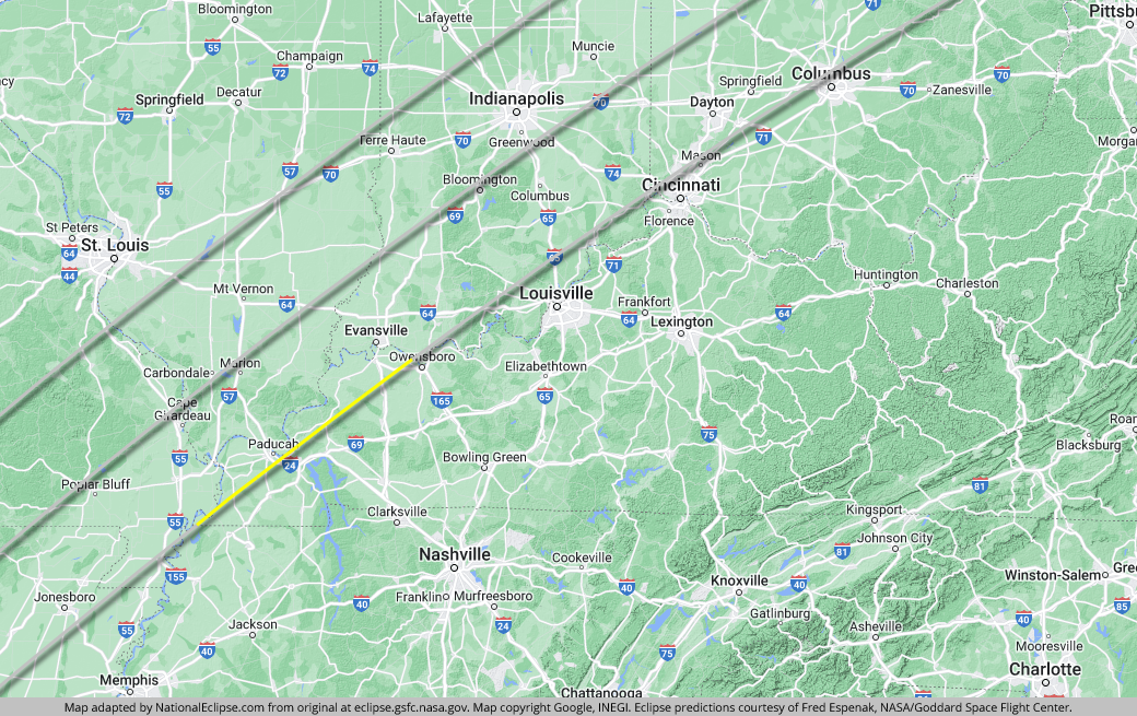
Paducah, which was also in the path of the historic 2017 eclipse, is very close to the eastern edge of the 2024 path. It will receive only about 1 minute and 31 seconds of totality downtown, even less than what it experienced during the much shorter overall eclipse of 2017. From Paducah, drive north on Interstate 24 into Illinois to find longer durations of totality closer to the centerline. Farther along, Henderson is also close to the edge, but it fares a bit better than Paducah, with about 2 minutes and 30 seconds of totality in the downtown area. For longer durations, hop over the Ohio River and take Interstate 69 to Interstate 64, which meets up with the centerline to the west.
(hover or tap to see points of interest in Kentucky)
The centerline of the eclipse enters Indiana as it crosses the Wabash River at approximately 1:47pm EDT, with totality beginning in that location at about 3:02pm EDT.
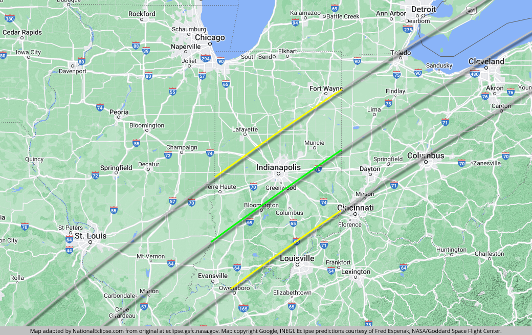
The path of totality arrives in Indiana on a collision course with the core of the state and with several large Indiana cities sitting happily in its crosshairs. The arrival of the eclipse in Indiana also represents the start of its journey through the "Rust Belt" of America where it will cross over or come close to a plethora of major northern cities and population centers where millions of people will have a chance to see nature's greatest show.
Evansville is located between the centerline and the eastern limit of the eclipse path, good enough for totality durations to break the 3-minute mark in many parts of this Ohio River town. In downtown Evansville, totality will last for about 3 minutes and 3 seconds. East of Evansville, the eclipse passes through much of Hoosier National Forest. On the western side of the eclipse path, Terre Haute, which has cleverly taglined their eclipse celebration as "A Total Eclipse of the Haute," is far enough inside the path for totality durations to surpass the 3-minute mark in some areas of the city. In the downtown area, Terre Haute will get about 2 minutes and 57 seconds of totality. But in Indiana, Bloomington wins the eclipse lottery, located almost directly on the centerline. For a total solar eclipse, the centerline is where the duration of totality lasts the longest in any one area, and the lucky residents of Bloomington will enjoy durations that exceed the 4-minute mark. In the downtown Bloomington area, the Sun will go dark for about 4 minutes and 2 seconds.

About two-thirds of the way to the centerline from the western limit of the eclipse path is Indianapolis, the largest city in the U.S. outside of Texas with a direct hit of totality on April 8. And with a duration of totality of about 3 minutes and 49 seconds in downtown Indy, Indiana's capital city is promised more than its fair share of darkness on eclipse day. Farther along the path, Muncie fares just about as well as Indianapolis, situated more than halfway to the centerline from the western edge of the eclipse path. In downtown Muncie, observers can expect about 3 minutes and 47 seconds of totality.
For eclipse chasers who don't mind driving into the path of totality on eclipse day, Louisville is quite close on the eastern side of the path. Drive west on Interstate 64 or north on Interstate 65 to reach totality in less than an hour. Fort Wayne is even closer on the western side of the path, with the city brushing right up against the totality line. All over Indiana, the interstate system makes getting around and getting near the centerline easy. Interstate 74 and I-65 both bisect the entire width of the path of totality and run through Indianapolis and Interstate 69 parallels the centerline for a 30-mile stretch near Bloomington.
The centerline of the eclipse exits the state at approximately 4:25pm EDT, with totality coming to an end in that location at about 3:12pm EDT. From the Illinois-Indiana border to the Indiana-Ohio border, the Moon's shadow travels approximately 183 miles along the centerline in 5 minutes and 24 seconds at an average speed of 2,038 miles per hour.
(hover or tap to see points of interest in Indiana)
The centerline of the eclipse enters Ohio at approximately 1:53pm EDT, with totality beginning in that location at about 3:08pm EDT.
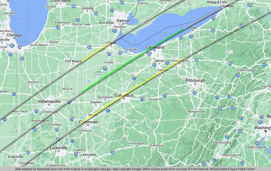
Much like its trip through Indiana, the eclipse paints a bullseye on several large cities in Ohio. At the same time, it comes excruciatingly close but misses a couple of others. Dayton is one of the lucky cities, located off the eastern edge of the eclipse path about a third of the way to the centerline. In downtown Dayton, totality will last for about 2 minutes and 43 seconds, longer than the maximum duration anywhere during the historic 2017 eclipse but considered merely respectable for our 4-minute-plus eclipse of 2024. South of Dayton, the path of totality barely misses Cincinnati. Unfortunate, yes, but especially so, considering the fact that a total solar eclipse hasn't occurred in what constitutes present-day Cincinnati since the year 1395 (and there won't be another one for at least 1,000 years). It's a quick and easy trek into the eclipse path, however, and eclipse fans can use Cincinnati as a convenient home base with plenty of lodging. From Cincinnati, Interstate 74 meets up with the centerline in Indiana and Interstate 75 runs through Dayton and connects with the centerline in Ohio.
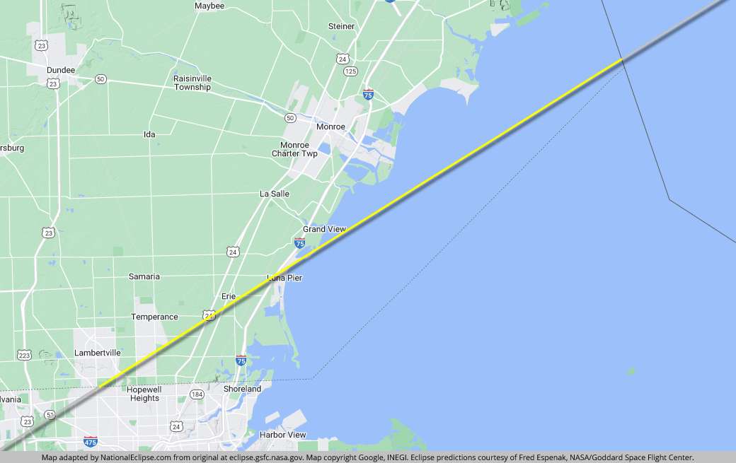
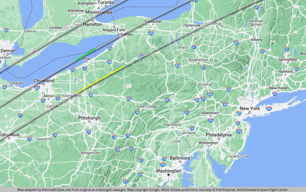
Toledo is situated right along the western limit of the eclipse path, resulting in rather modest durations of totality for this Lake Erie city. In downtown Toledo, totality will last for about 1 minute and 53 seconds, with durations decreasing quickly as you go north and west and with a small area of northwestern Toledo outside the path. For longer durations, Toledoans can drive south on I-75, which eventually connects with the centerline. Above Toledo, in Michigan, Detroit is about an hour away from totality and can make a good base of operations for eclipse chasers. I-75 will get you to the path and all the way to the centerline (Detroiters can also reach totality by crossing into Canada and driving to the northern shores of Lake Erie). On the other side of the eclipse path, Columbus, Ohio's capital and largest city, is perched right on the edge of the path. Although some areas in the northwestern part of the city are inside the path of totality, most of Columbus will experience a partial solar eclipse only. But its wealth of lodging options and its extremely close proximity to the path will make the city a great basecamp for expeditions into the totality zone.
About halfway through the state, the western line of the eclipse path hops out of the U.S. and into Canada, not to re-enter again until Maine. This is also when the centerline and the western side of the eclipse path head out into Lake Erie. Unfortunately, it won't be July or August, but you can bet that plenty of boaters will be out on the lake to witness the show from the water. In fact, somewhat surprisingly, meteorologists think the frigid waters of Lake Erie (and, farther along the path, Lake Ontario) in early April might actually inhibit the formation of clouds over the lake. Although an eclipse viewing on the water might be a chilly experience, it might also offer better weather prospects than locations farther inland.

Cleveland is very close to the eclipse centerline, which is over water at this point, and the lucky citizens of this lakeside city can expect very generous durations of totality on April 8. In downtown Cleveland, totality will last for about 3 minutes and 49 seconds. With such a long duration of darkness and with plenty of lakeside viewing spots, Cleveland will certainly be rocking on April 8, 2024. Interstate 90 parallels the centerline from Cleveland all the way to the Pennsylvania border. West of Cleveland, I-90 crosses the centerline as it curves around the lake and heads to Toledo. South of Cleveland, it will be a "Goodyear" in the Rubber Capital of the World when the eclipse comes to Akron, with totality clocking in at around 2 minutes and 46 seconds in the downtown district. And about halfway between Cleveland and Akron is Cuyahoga Valley National Park, one of only two U.S. national parks located along the 2024 path of totality.
The centerline of the eclipse exits the state over Lake Erie at approximately 4:30pm EDT, with totality coming to an end in that location at about 3:19pm EDT. From the Indiana-Ohio border to the Ohio-Pennsylvania border, the Moon's shadow travels approximately 263 miles along the centerline in 7 minutes and 28 seconds at an average speed of 2,110 miles per hour.
(hover or tap to see points of interest in Ohio)
The centerline of the eclipse enters Pennsylvania over Lake Erie at approximately 2:01pm EDT, with totality beginning in that location at about 3:15pm EDT.
The eclipse takes a relatively short jaunt through Pennsylvania, crossing over the northwestern corner of the state. Technically, the centerline does run through Pennsylvania, but it's entirely over water—it scoots across Lake Erie on the U.S. side of the border with Canada that divides the lake in half. Unless they have a boat, nobody will see totality on the centerline in the Keystone State. The western line of the eclipse path doesn't make it into Pennsylvania at all, having exited the U.S. for Canada back in Ohio.

The largest city along the eclipse path in Pennsylvania, and the only one with any significant population, is Erie. Located less than 20 miles away from the waterborne cenerline, the lakeside city is about as close to the centerline as you can get in Pennsylvania without getting your feet wet. In the downtown area, totality will last for a very generous 3 minutes and 40 seconds. And if that's not enough, you can even squeeze a few additional seconds of darkness out of your experience by driving out onto Presque Isle State Park, which juts out into the lake. All along the shore of Lake Erie in Pennsylvania, Interstate 90 provides access to lakeside viewing and the longest durations in the state.
Pittsburgh is a little over an hour away from totality on the eastern side of the eclipse path. On eclipse day, drive north on Interstate 79 to reach totality in Pennsylvania or west on Interstate 76 to reach the path in Ohio. Before exiting Pennsylvania, the path of totality crosses over the northern reaches of Allegheny National Forest, but durations of totality will be relatively short here along the eastern edge of the path.
The centerline of the eclipse exits the state over Lake Erie at approximately 4:31pm EDT, with totality coming to an end in that location at about 3:20pm EDT. From the Ohio-Pennsylvania border to the Pennsylvania-New York border, the Moon's shadow travels approximately 44 miles along the centerline in 1 minute and 12 seconds at an average speed of 2,223 miles per hour.
(hover or tap to see points of interest in Pennsylvania)
The centerline of the eclipse enters New York over Lake Erie at approximately 2:03pm EDT, with totality beginning in that location at about 3:16pm EDT.
The path of totality traces a grand arc across western and northern New York, crossing both large cities and high peaks. Although New York shares the eclipse with Canada for the length of its journey across the state, most of the width of the path belongs to New York and the centerline travels through the Empire State exclusively.

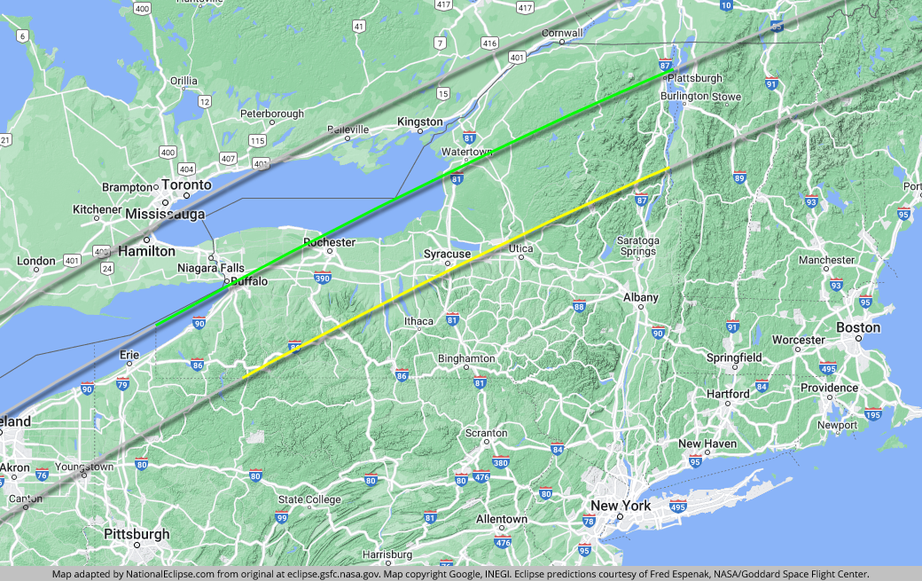
When it enters the state, the centerline is still over Lake Erie, but it soon touches land again when it crosses directly over Buffalo. So often the punchline of jokes, Buffalo gets the last laugh on April 8 with a very lengthy duration of totality lasting for about 3 minutes and 45 seconds downtown. Just north of Buffalo, you can be sure that scores of people will want to witness the show in the sky with one of Earth's great natural wonders as a backdrop. It will be a surreal experience in Niagara Falls USA where totality will last for about 3 minutes and 31 seconds in the downtown area. As it does in Pennsylvania and Ohio, Interstate 90 parallels the centerline along the shore of Lake Erie in western New York all the way to Buffalo.
The centerline doesn't stay over dry land for long. It soon heads out into open water again, this time Lake Ontario. As is the case with Lake Erie to the west, weather experts think the cold lake waters could aid eclipse viewers by preventing clouds from forming above and around the lakes. On the southern shore of Lake Ontario, Rochester is very close to the centerline at this point and totality will last for about 3 minutes and 39 seconds in the downtown. After crossing through the Finger Lakes region of New York, the eclipse crosses over Syracuse. Situated near the eastern limit of the path, Syracuse will get about 1 minute and 24 seconds of totality downtown but longer durations can be reached by driving north on Interstate 81, which meets up with the centerline.

As it reaches the eastern shore of Lake Ontario, the centerline once again touches down on New York soil and the path of totality heads across northern New York to the Adirondack Mountains. The Adirondacks promise to be one of the most scenic places to view the 2024 eclipse, but high elevations can produce clouds and the weather in early April could be unpredictable in this part of the country. Many of the beautiful mountain lakes, which otherwise would be the perfect setting for an eclipse viewing, might still be frozen during this time of the year. Make sure to check short-term weather forecasts for the region in the days leading up to the eclipse.
Lake Champlain stretches across the entire width of the eclipse path in New York and will offer plenty of scenic viewing opportunities. Interstate 87 bisects the eclipse path as it parallels Lake Champlain and the border with Vermont and will make getting into totality easy for travelers coming up from downstate New York.
The centerline of the eclipse exits the state as it crosses Lake Champlain at approximately 4:37pm EDT, with totality coming to an end in that location at about 3:29pm EDT. From the Pennsylvania-New York border to the New York-Vermont border, the Moon's shadow travels approximately 359 miles along the centerline in 8 minutes and 57 seconds at an average speed of 2,405 miles per hour.
(hover or tap to see points of interest in New York)
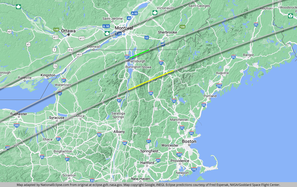
The centerline of the eclipse enters Vermont as it crosses Lake Champlain at approximately 2:14pm EDT, with totality beginning in that location at about 3:25pm EDT.
It's a relatively short journey for the path of totality in Vermont. The centerline only travels about 40 miles through the state and the western line of the eclipse is in Canada.

As is the case on the New York side of the state border, Lake Champlain promises to offer a scenic eclipse experience either on the water or on the shore. It spans the entire width of the eclipse path in Vermont. Beyond the lake, two noteworthy cities in Vermont will witness totality on eclipse day. Burlington, the state's largest city, is situated more than halfway to the centerline from the eastern limit of the path and will get about 3 minutes and 15 seconds of totality in the downtown district along the eastern shores of Lake Champlain. Montpelier, the state capital, is located a lot closer to the eastern edge and will get about 1 minute and 35 seconds of totality downtown.
The eclipse crosses over the Green Mountains in Vermont and, like in the Adirondacks back in New York, the wise eclipse chaser should be wary of cloudy skies and consult short-term weather forecasts for the region. Two interstates cross the width of the path in Vermont. Interstate 89 comes up to Montpelier, heads west to Burlington, and then north to the centerline and beyond. Farther east, Interstate 91 bisects the path of totality in Vermont. Vermont is also the place where the centerline finally exits the U.S. for Canada. But it will race across Québec, missing New Hampshire, and soon re-enter the U.S. again in Maine.
The centerline of the eclipse exits the state as it crosses the U.S.-Canada border at approximately 4:37pm EDT, with totality coming to an end in that location at about 3:30pm EDT. From the New York-Vermont border to the Vermont-Québec border, the Moon's shadow travels approximately 40 miles along the centerline in 54 seconds at an average speed of 2,674 miles per hour.
(hover or tap to see points of interest in Vermont)
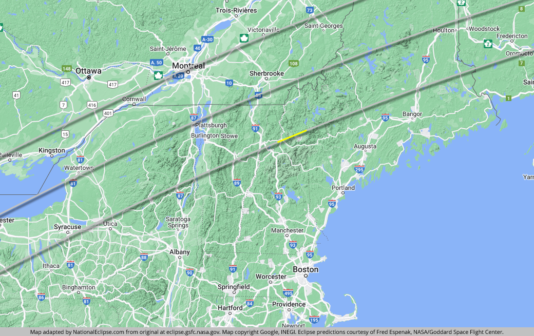
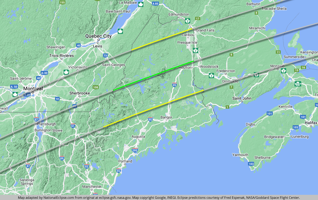
The 2024 eclipse comes to New Hampshire but it arrives without a centerline. Only the eastern line of the eclipse path enters New Hampshire, and only briefly; both the western line and the centerline bypass the Granite State for Canada. All told, only the narrow, northern top of the state—the Great North Woods—is captured inside the path. Once again, high elevations could produce cloudy conditions, with the White Mountains of New Hampshire replacing the Green Mountains of Vermont as the culprit.
Since the eclipse doesn't cover a lot of ground here, and since New Hampshire is a sparsely populated state anyway, it's not surprising that the eclipse never crosses a town with a population of at least 10,000 people. The largest town within the path is probably Lancaster, which straddles the exact edge of the path, cutting off some parts of the southern half of the town from totality. In Lancaster, totality will only last for about 43 seconds in the middle of town, with durations dropping off rapidly as you go south and east.
(hover or tap to see points of interest in New Hampshire)
The centerline of the eclipse enters Maine at approximately 2:18pm EDT, with totality beginning in that location at about 3:29pm EDT.
After entering the U.S. in Texas and traveling approximately 1,894 miles along the centerline in about 59 minutes and 10 seconds at an average speed of 1,920 miles per hour, the Moon's shadow begins the last leg of its journey across America. Indeed, as if on cue to celebrate this homestretch in the U.S., the centerline re-enters the States after a brief foray into Canada. In fact, Maine even reaches up to intercept the western line of the eclipse path, which ditched the U.S. for Canada way back in Ohio. For the first time in over 700 miles, the entire path of totality once again belongs exclusively to the United States. The downside, though, is that this stretch of eclipse track is perhaps the most prone to cloudy conditions in the entire U.S.

The path travels through the dense western forests of Maine, arguably the most remote region of land along the entire eclipse track in the U.S. It's endless miles of wilderness in these hinterlands with few signs of civilization. The centerline crosses almost directly over Mount Katahdin, the tallest mountain in Maine and the northern terminus of the famous Appalachian Trail. Farther east, more towns are peppered across the path, but as was the case in New Hampshire, the path never crosses a town with a population of at least 10,000 people. The largest town within the path is probably Presque Isle, along the eastern border with Canada, where totality will last for about 2 minutes and 49 seconds in the middle of town.
Interstate 95 crosses into the path of totality as it comes up from downstate Maine and it approaches the centerline before veering off to the east. The centerline itself last touches U.S. soil at the border with New Brunswick before heading out into Canada's Maritime provinces and Newfoundland before concluding its journey in the Atlantic Ocean.
The centerline of the eclipse exits the state, and the U.S., as it crosses the U.S.-Canada border at approximately 4:41pm EDT, with totality coming to an end in that location at about 3:35pm EDT. From the Québec-Maine border to the Maine-New Brunswick border, the Moon's shadow travels approximately 148 miles along the centerline in 3 minutes and 6 seconds at an average speed of 2,868 miles per hour.
(hover or tap to see points of interest in Maine)
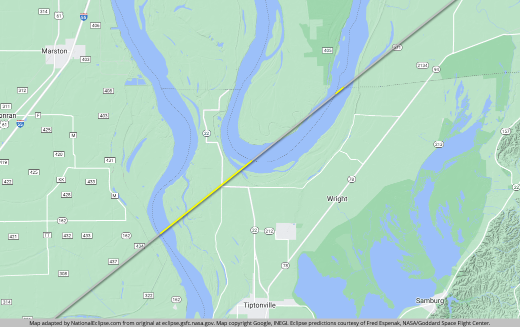
The eclipse crosses over tiny portions of two additional states on April 8, 2024. As it crosses the Mississippi River and leaves Missouri, the eastern line of the eclipse path travels about 4 miles through an oddly-shaped piece of land in Tennessee formed by the bends in the river before crossing back into Missouri and then into Kentucky. Farther north, as it exits Ohio at Toledo, the western line travels about 31 miles in Michigan, 11 of those miles over land and 20 over Lake Erie, before it enters into Canada.
(hover or tap to see details)
(hover or tap to see details)