(This is an archived page about the annular solar eclipse that occurred on October 14, 2023. For information on future eclipses, please see our Upcoming Eclipse Maps page.)
On October 14, 2023, an annular, or "ring of fire," solar eclipse will carve a narrow path of annularity from northwest to southeast across eight U.S. states. To experience the annular, or "ring of fire," phase of the eclipse, you must be located within this narrow path of annularity, with the duration of annularity lasting the longest at the centerline. But where along the path should you plan to go? Below, we've outlined some of the unique features, landmarks, and viewing options along the path of annularity for each state.
Remember that you must use special eclipse safety glasses or viewers at all times during an annular, or "ring of fire," solar eclipse. The NationalEclipse.com Eclipse Store offers a wide variety of certified safe eclipse glasses and viewers.
Note that times and durations can vary widely even within the same city and some cities are located only partially within the path of annularity. All times and durations noted on this page are only representative samples and should be used for general comparison purposes only.
To avoid confusion, note that references made below to the "western" and "eastern" limits or lines of the eclipse refer respectively to the left/bottom and right/top edges of the eclipse path as it gradually changes its direction from east to south as it travels across the U.S.
The centerline of the eclipse enters the U.S. in Oregon at approximately 8:05am PDT, with annularity beginning in that location at about 9:15am PDT.
When it first touches U.S. soil on the coast of Oregon on Saturday morning, having been born out in the Pacific Ocean only about 5 minutes earlier, the eclipse will be very low in the sky. At only about five degrees above the horizon at the start of the partial phase and about 17 degrees during annularity, observers will need to find a location free of tall buildings, trees, and terrain in the direction of the Sun. Oregon's beaches will likely be a popular gathering spot within the 137-mile-wide path of annularity, but remember that the Sun will be rising in the east, not over the water. The maritime climate along the coast could also produce morning clouds and fog that might obscure the view.
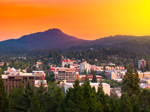
Better weather might be found farther inland in the valleys beyond the Coast Range, but even there morning fog might be a problem and the Cascades to the east might obstruct a view of the rising Sun. Eugene is located between the centerline and the eastern limit of the eclipse path, with annularity lasting for about 3 minutes and 55 seconds in the downtown area. Interstate 5 crosses the entire width of the eclipse path between the Coast Range and the Cascades. Although Portland and Salem aren't located within the path of annularity, they're close enough to serve as convenient basecamps for viewing spots farther south along I-5.
The stunning Crater Lake National Park might be an appropriate place to view an eclipse (craters...Moon...get it?) and it's located relatively close to the centerline. If you decide to view the eclipse from here or anywhere else in the cloud-prone Cascades, make sure to check short-term weather forecasts in the days before the eclipse. Keep in mind, also, that it snows here in October.
Beyond the Cascades, the path of annularity descends down into Oregon's high desert, which promises a relatively good possibility of favorable eclipse-watching weather. Klamath Falls is located between the centerline and the western edge of the eclipse path, with annularity lasting for about 3 minutes and 23 seconds in the downtown area.
The centerline of the eclipse exits the state at approximately 10:44am PDT, with annularity coming to an end in that location at about 9:23am PDT. From the Pacific Ocean to the Oregon-Nevada border, the Moon's shadow travels approximately 276 miles along the centerline in 3 minutes and 18 seconds at an average speed of 5,025 miles per hour.
(hover or tap to see points of interest in Oregon)
California gets an annular solar eclipse in 2023, but not the California most people know. There won't be a ring of fire over San Francisco or Los Angeles on October 14. Only the remote northeastern corner of the state is captured within the path of annularity and the eclipse centerline misses the state completely.
The eclipse path runs almost exclusively through Modoc County, the third least-populated county in the state. As such, the path never crosses a town with a population of at least 10,000 people. The most populated town over which the eclipse travels in California is probably Alturus. Alturus, however, sits right along the western edge of the eclipse path, with annularity lasting for only about 1 minute and 58 seconds in the middle of the town.
Overall, the best place to see the eclipse in California might be the sparsely populated Surprise Valley, which runs parallel to the border with Nevada. Surprise Valley not only offers relatively favorable odds for good weather on eclipse day, but the northern end of the valley is as close to the centerline as one can get in the state.
(hover or tap to see points of interest in California)
The centerline of the eclipse enters Nevada at approximately 8:06am PDT, with annularity beginning in that location at about 9:19am PDT.
The eclipse slices through most of northern Nevada, missing large cities like Las Vegas and Reno. Indeed, when it first enters the remote northwestern corner of the state, the path of annularity crosses miles and miles of barren desert containing little more than a few ghost towns and abandoned homesteads.
Farther east, the state becomes more populated, especially along Interstate 80. I-80 cuts across the entire width of the eclipse path in Nevada and will make getting to the centerline easy. Elko is located between the centerline and the eastern line of the eclipse path, with annularity lasting for about 4 minutes and 18 seconds in the downtown district of the city.
All throughout Nevada, the weather odds should be relatively favorable on eclipse day as the path of annularity travels the vast topography of arid mountain ranges and valleys known as the Great Basin. The chances of precipitation will be low and the chances for sunny skies should be relatively high, especially in the valleys.
To the west, Reno is less than two hours away from the eclipse path via I-80. To the east, Salt Lake City is also less than two hours away. From Salt Lake, I-80 will take you right up to the edge of the eclipse path and a quick jog down U.S. Route 93 Alt will take you into annularity and all the way to the centerline via the main spur of U.S. Route 93. Both cities can serve as convenient bases of operation for expeditions into the annularity zone on October 14.
Before leaving the state, the eclipse crosses over Great Basin National Park, including Wheeler Peak, the second-highest mountain in Nevada.
The centerline of the eclipse exits the state at approximately 10:53am PDT, with annularity coming to an end in that location at about 9:28am PDT. From the Oregon-Nevada border to the Nevada-Utah border, the Moon's shadow travels approximately 324 miles along the centerline in 5 minutes at an average speed of 3,888 miles per hour.
(hover or tap to see points of interest in Nevada)
The centerline of the eclipse enters Utah at approximately 9:08am MDT, with annularity beginning in that location at about 10:24am MDT.
As it enters Utah, the eclipse track continues its journey through the arid multi-state Great Basin, where the chances for cloud-free skies should be relatively favorable. Farther ahead, the path of annularity crosses over Dixie National Forest, Fishlake National Forest, and Manti-La Sal National Forest. These forested areas will make for scenic eclipse viewing, but remember that the Sun is still only about 30 degrees above the horizon at this point. If you'll see the eclipse from any of these areas, make sure to position yourself where trees and terrain won't be in the way. Remember, also, that higher elevations means a greater chance for clouds.
The eclipse misses any cities of significant population in Utah, never crossing a town with a population of at least 10,000 people. The most populated town over which the eclipse travels in Utah is probably Richfield, where annularity will last for about 4 minutes and 37 seconds in the middle of town, a very generous duration for this eclipse. Richfield is located on Interstate 70, which enters the path from the east and crosses the centerline before terminating its route when it meets up with Interstate 15. I-15 crosses the entire width of the eclipse path, linking Salt Lake City from the north and Las Vegas from the south. You should be able to reach the path from Vegas in under three hours while a trip from Salt Lake will require only about half that time. Both cities, with their extensive lodging options, can serve as basecamps.
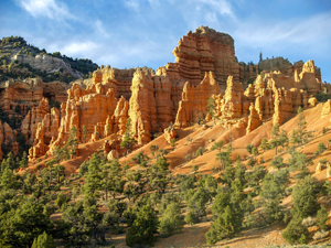
Beyond the forests, the eclipse enters that region of southern Utah known for its plethora of natural wonders. Among the "Mighty 5" national parks in Utah, the path of annularity crosses over three of them: Bryce Canyon National Park, Capitol Reef National Park, and Canyonlands National Park. And the other two—Zion National Park and Arches National Park—are located close by on the western and eastern flanks of the eclipse path, respectively. If all that wasn't enough, the eclipse path also crosses over Grand Staircase-Escalante National Monument, Glen Canyon National Recreation Area, and Natural Bridges National Monument. Needless to say, this entire region of southern Utah promises to offer some of the most spectacular natural backdrops for an eclipse viewing. Plus, the chances are high that the weather will cooperate here.
No description of southern Utah would be complete without a mention of the Four Corners Monument, which the eclipse crosses over. As the only location in the United States where four states meet, the monument placed at this exact quadripoint where the corners of Arizona, Colorado, New Mexico, and Utah come together is a popular tourist attraction. There's not much else around the monument itself, and it will likely be a popular viewing site on eclipse day, so a visit to the monument might best be saved for the days before or after the eclipse to avoid crowds. (UPDATE: Navajo Nation, which administers Four Corners, has announced they are closing tribal parks during the eclipse in observance of cultural beliefs.)
The centerline of the eclipse exits the state at approximately 12:02pm MDT, with annularity coming to an end in that location at about 10:34am MDT. From the Nevada-Utah border to the Utah-Arizona border, the Moon's shadow travels approximately 305 miles along the centerline in about 5 minutes and 49 seconds at an average speed of 3,146 miles per hour.
(hover or tap to see points of interest in Utah)
The centerline of the eclipse enters Arizona at approximately 9:10am MDT, with annularity beginning in that location at about 10:30am MDT.
Only the extreme northeastern corner of Arizona is captured inside the eclipse path. Although the eastern line of the eclipse misses the state completely, the centerline does make an appearance, but it doesn't stick around for long. All told, the centerline races across a mere 28 miles of the high Arizona desert.
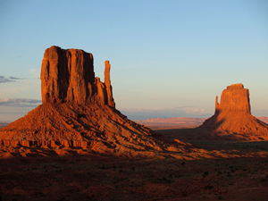
In Arizona, almost the entire eclipse path belongs to the Navajo Nation, offering visitors a variety of historical and cultural attractions and experiences. Along the Utah-Arizona border, the eclipse crosses over the sandstone buttes of the world famous Monument Valley area, most easily seen from U.S. Route 163, and the already-mentioned Four Corners Monument, where the state lines of Arizona, Colorado, New Mexico, and Utah come together. (UPDATE: Navajo Nation, which administers Four Corners and Monument Valley, has announced they are closing tribal parks during the eclipse in observance of cultural beliefs.)
Since this is sparsely populated Navajo land, it's not surprising that the eclipse path never crosses any large towns or cities here, certainly none with a population of more than 10,000 people. The most populated town over which the eclipse travels in Arizona is probably Kayenta—population about 5,000—where annularity will last for about 3 minutes and 39 seconds in the center of town.
By this point, the eclipse path has made the transition from the high desert of the Great Basin to the high desert of the Colorado Plateau, where the chances of cloudless skies on eclipse day are even better. What's more, the Grand Canyon is located only a day trip to the west. For travelers who want to combine an eclipse viewing expedition in Navajo country with a trip to one of the world's most famous natural wonders, Arizona is a great choice.
The centerline of the eclipse exits the state at approximately 12:03pm MDT, with annularity coming to an end in that location at about 10:35am MDT. From the Utah-Arizona border to the Arizona-New Mexico border, the Moon's shadow travels approximately 28 miles along the centerline in about 38 seconds at an average speed of 2,666 miles per hour.
(hover or tap to see points of interest in Arizona)
Colorado makes the eclipse cut on October 14, but just barely. Only a small triangle of the state, smaller even than Arizona's share, is captured within the eastern line of the eclipse path and the centerline bypasses Colorado completely.
Once again, the eclipse enters a state in which it never crosses a town with a population of at least 10,000 people—although Cortez, with its 8,000-plus residents, comes close. Cortez is located far enough away from the edge of the path that annularity will still last for about 3 minutes and 4 seconds in the middle of town.
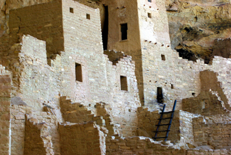
In Colorado, the eclipse crosses over Canyons of the Ancients National Monument, the largest concentration of native archaeological sites in the U.S., as well as Mesa Verde National Park, known for its Ancestral Puebloan cliff dwellings. The eclipse also crosses over parts of the Ute Mountain Reservation and the Southern Ute Reservation.
And, of course, annularity will be seen at the extreme southwestern corner of the state, where the Four Corners Monument marks the location where the corners of Arizona, Colorado, New Mexico, and Utah meet up. (UPDATE: Navajo Nation, which administers Four Corners, has announced they are closing tribal parks during the eclipse in observance of cultural beliefs.) As is the case across the border in Utah, Arizona, and New Mexico, the chances for fair skies should be favorable in Colorado on October 14.
(hover or tap to see points of interest in Colorado)
The centerline of the eclipse enters New Mexico at approximately 9:11am MDT, with annularity beginning in that location at about 10:30am MDT.
The 2023 eclipse cuts right across the heart of New Mexico on a diagonal from its northwestern corner to its southeastern corner. New Mexico, with its high desert landscapes, promises a great chance for cloud-free skies on eclipse day. In fact, eclipse weather forecasting site eclipsophile.com says the Colorado Plateau region of New Mexico, Arizona, and Colorado offers the "best eclipse-watching weather along the track."
If you'd like to attempt to view an eclipse from four different states at the same time, make plans to be at the Four Corners Monument on eclipse day, but be prepared to have some competition. The famous tourist attraction marking the only point in the U.S. shared by four states will likely be swarming with eclipse viewers on October 14 vying for that same distinction. Time will tell whether Navajo Nation, which administers the site, will limit visitor capacity that day. (UPDATE: Navajo Nation, which administers Four Corners, has announced they are closing tribal parks during the eclipse in observance of cultural beliefs.)
Beyond the Four Corners area, and along the first stretch of its journey through the Land of Enchantment, the path of annularity crosses over parts of several Native American reservations, including lands belonging to the Ute, Navajo, Apache, and Pueblo peoples. Notably, the eclipse centerline passes directly over the fabulous Chaco Culture National Historical Park, one of the most extensive collections of pre-Columbian ruins in the U.S.
Farther on, the eclipse meets up with some of the largest cities along its path since Oregon. Santa Fe is located rather close to the eastern limit of the path, with an annularity duration a bit more modest than other locations closer to the eclipse centerline: about 2 minutes and 48 seconds in the downtown area. But what Santa Fe lacks in duration of annularity it more than makes up for with its artistic vibe and Southwestern architecture, ensuring that New Mexico's capital city will be a popular eclipse viewing destination on October 14. Just outside Santa Fe, the eclipse crosses over the Ancestral Puebloan ruins at Bandelier National Monument.

Albuquerque, the second largest city along the eclipse path in the U.S., is perfectly positioned for the eclipse centerline to pass directly over it, resulting in durations of annularity that surpass the 4-minute mark all around the city. In downtown Albuquerque, the ring of fire will burn for about 4 minutes and 50 seconds, only about 12 seconds short of the eclipse maximum in the United States. The eclipse happens to coincide with Albuquerque's annual International Balloon Fiesta, all but guaranteeing that the city will be jam-packed with visitors on October 14.
Albuquerque sits at the crosshairs of Interstate 40 and Interstate 25. I-40 runs across the width of the path from west to east while I-25 takes a more north-south heading. On the west side of the eclipse path, I-25 can be used to reach annularity from El Paso in under three hours. On the east side, Amarillo is an even shorter drive away via I-40.
Finally, it's worth noting that the eclipse does indeed cross over the city of Roswell, New Mexico. You can bet that more than a few people will want to witness the otherworldly phenomenon of a solar eclipse from the UFO capital of the world. Luckily, Roswell is located relatively close to the centerline and annularity will last for about 4 minutes and 42 seconds in the downtown district.
The centerline of the eclipse exits the state at approximately 12:19pm MDT, with annularity coming to an end in that location at about 10:46am MDT. From the Arizona-New Mexico border to the New Mexico-Texas border, the Moon's shadow travels approximately 442 miles along the centerline in about 10 minutes and 44 seconds at an average speed of 2,471 miles per hour.
(hover or tap to see points of interest in New Mexico)
The centerline of the eclipse enters Texas at approximately 10:17am CDT, with annularity beginning in that location at about 11:41am CDT.
After entering the U.S. in Oregon and traveling approximately 1,375 miles along the centerline in about 25 minutes and 29 seconds at an average speed of 3,239 miles per hour, the Moon's shadow begins the last leg of its journey across America. And with a centerline track of 494 miles, this last leg in Texas is also the longest leg in America, accounting for more than a quarter of the path's total length in the United States.
Midland and Odessa straddle the east and west sides of the eclipse centerline, respectively. In downtown Odessa, annularity will last for about 4 minutes and 49 seconds. Not bad, but Midland is a tad closer to the centerline, with annularity lasting for about 4 minutes and 55 seconds downtown, just 7 seconds short of the maximum duration of annularity anywhere in the country.
Interstate 20 bisects the entire width of the path in Texas and links it with El Paso to the west and the Dallas/Forth Worth area to the east, both only a day trip away. From El Paso, annularity can be reached by taking Interstate 10 to I-20. From Dallas, I-20 will take you all the way to annularity. To the north, Lubbock is even closer. You can reach the path in less than an hour by driving south on U.S. Route 87.

Farther along, the eclipse crosses over the largest city it will encounter along its journey through the United States. San Antonio is located about halfway between the centerline and the eastern limit of the eclipse path, with annularity lasting for about 4 minutes and 21 seconds downtown. In fact, it's important to note that all of San Antonio is located inside the 2023 eclipse path, which unfortunately is not the case six months later when only a portion of the city is captured inside the path of the total solar eclipse that will sweep across the U.S. on April 8, 2024. The lucky citizens of San Antonio will have a chance to experience two solar eclipses in the span of only six months, but only this annular solar eclipse on October 14, 2023, will cross over the heart of the city. To the west of San Antonio, a large diamond-shaped area in the Texas Hill Country is where the 2023 annular solar eclipse path overlaps with that of the 2024 total solar eclipse. The exact point where the centerlines cross is near the tiny town of Vanderpool.
Interstate 10 enters the eclipse path from the west before crossing the centerline and turning south to meet up with San Antonio. Interstate 35 crosses the entire width of the eclipse path, coming in from the south, crossing the centerline and San Antonio, and heading off toward Austin. In fact, Austin is so close to the eastern edge of the eclipse path that it can make an extremely convenient basecamp for eclipse chasers who prefer the fun of Austin over the fun of San Antonio. On eclipse day, it's a quick drive south on I-35 to reach the path. Houston is also relatively close on the east side. Drive west on I-10 to reach the path in less than three hours. Interstate 37 runs south from San Antonio down to the coast, tracing a path almost directly over the centerline. All of these interstate highways will make getting around this part of Texas easy on eclipse day, especially if cloudy skies requires a quick move to a different location.

The last major port of call for the eclipse in the U.S. is Corpus Christi. Since entering the U.S. in the Pacific Northwest, the eclipse's duration of annularity—or how long the Sun will appear as a perfect "ring of fire" in the sky—will have been steadily increasing, with the shortest durations on the Oregon coast and the longest durations here on the Gulf coast. What's more, the centerline of the eclipse—where durations last the longest in any one area—slices directly through the center of Corpus Christi. The result is a duration of annularity for this Gulf Coast city that cracks the 5-minute mark in some parts of town, including about 5 minutes and 2 seconds in the downtown area. These long durations make Corpus Christi a great eclipse-watching destination if you want the longest experience possible in the U.S. Just make sure to check short-term weather forecasts for the possibility of cloudiness along the shore during the late-morning hours. Obviously, a long duration of annularity is meaningless if you can't see the eclipse. The centerline last touches U.S. soil as it crosses over the city's barrier islands before heading out into the Gulf of Mexico, crossing through Central America and South America, and concluding its long journey in the Atlantic Ocean off the coast of Brazil.
The centerline of the eclipse exits the state, and the U.S., at approximately 1:38pm CDT, with annularity coming to an end in that location at about 12:01pm CDT. From the New Mexico-Texas border to the Gulf of Mexico, the Moon's shadow travels approximately 494 miles along the centerline in about 15 minutes and 1 second at an average speed of 1,972 miles per hour.
(hover or tap to see points of interest in Texas)
(hover or tap to see points of interest in Texas)
The eclipse crosses over a tiny portion of one additional state on October 14, 2023. As it leaves Oregon, the eastern line of the eclipse path travels about 14 miles through Idaho before crossing into Nevada.
(hover or tap to see details)