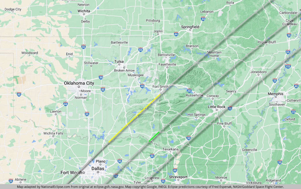
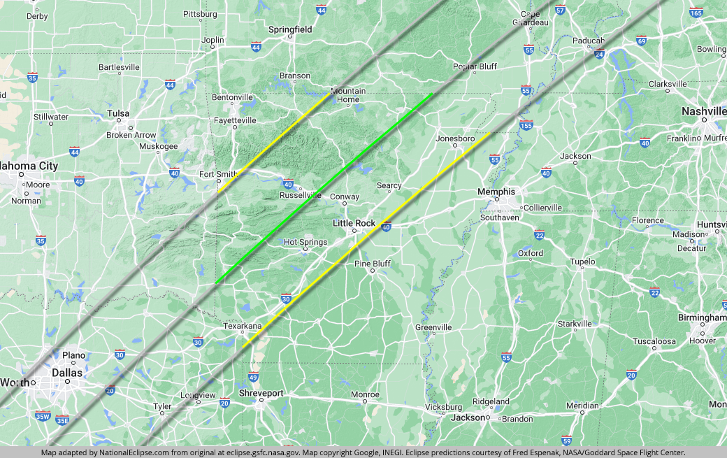
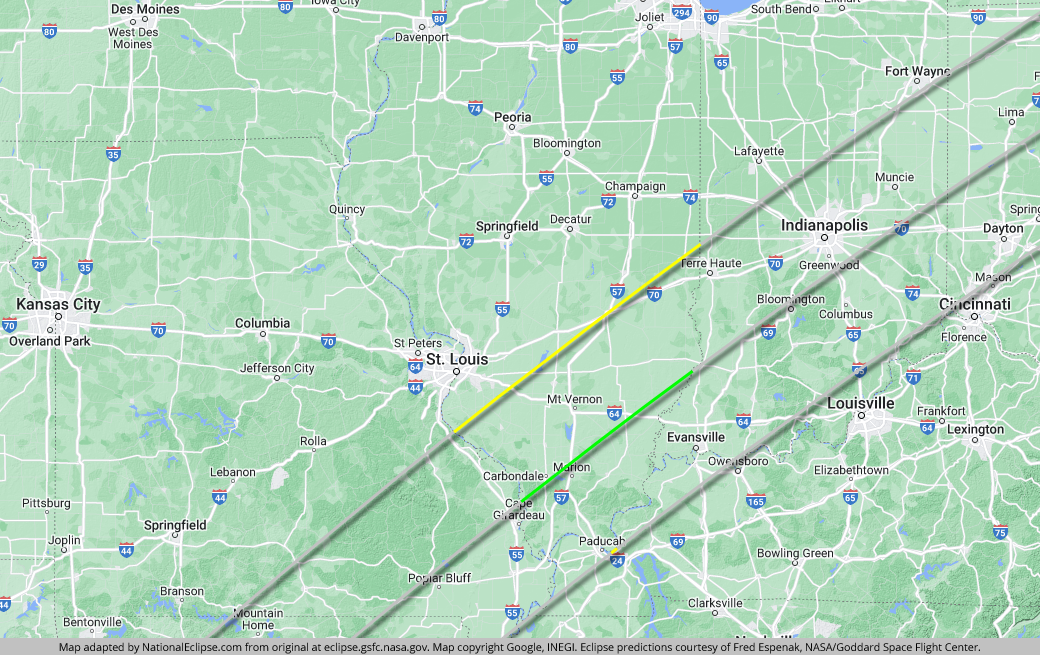
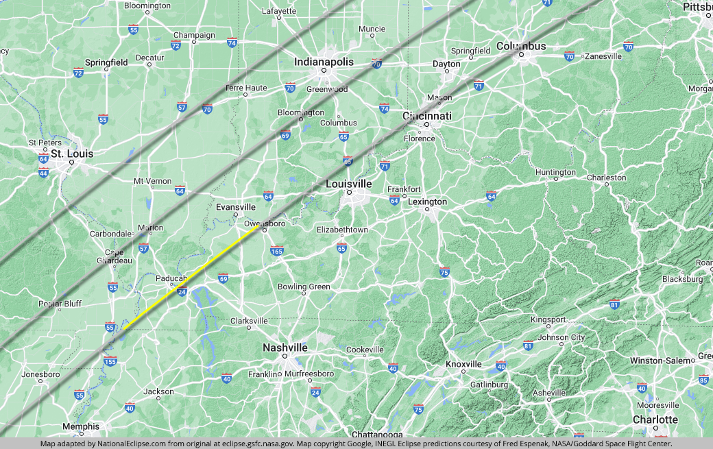
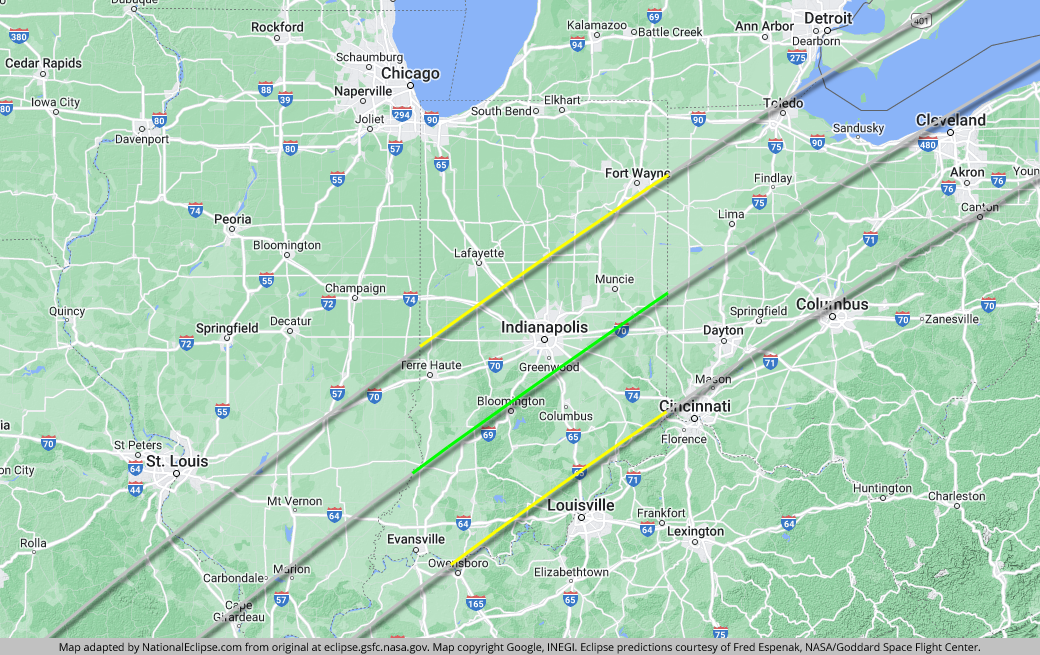
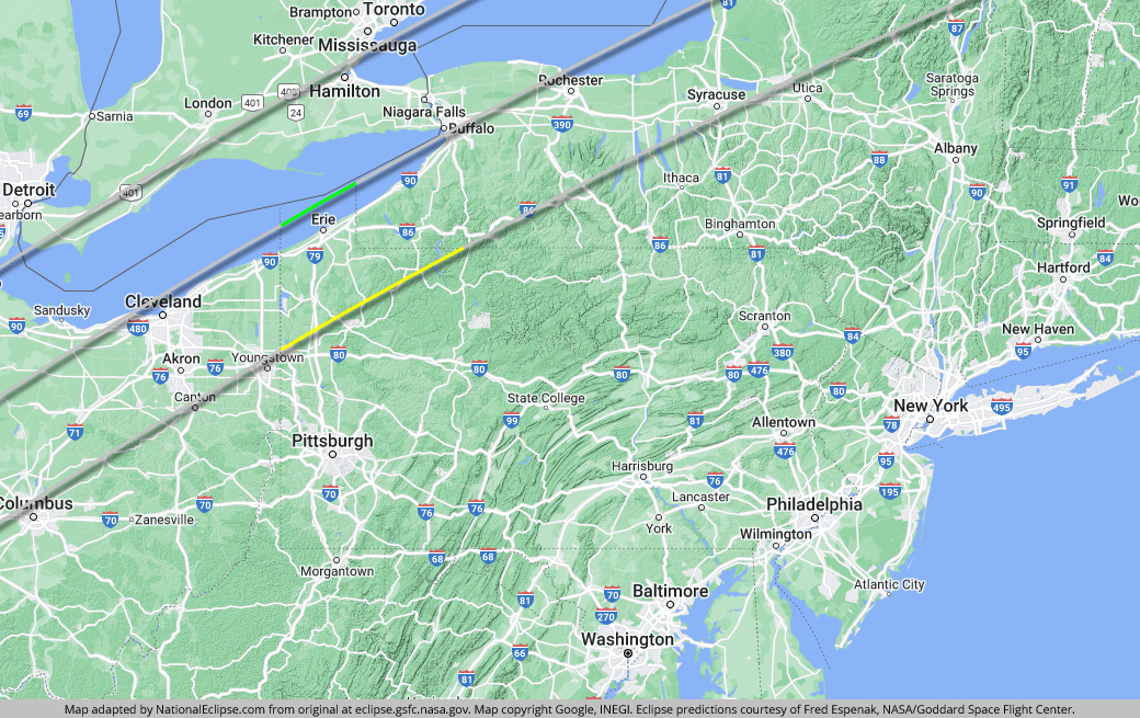
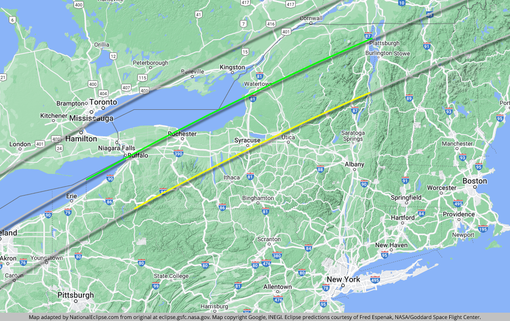
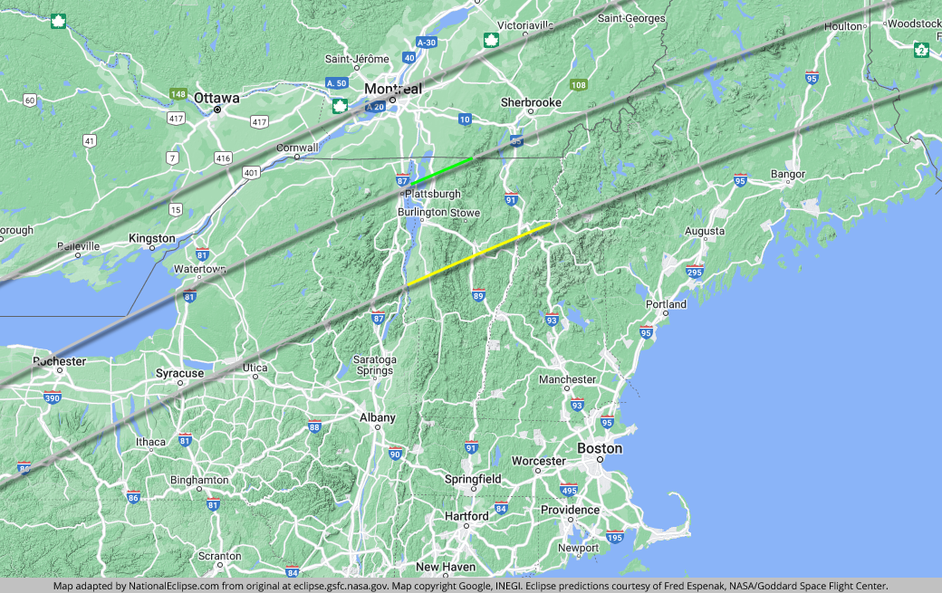
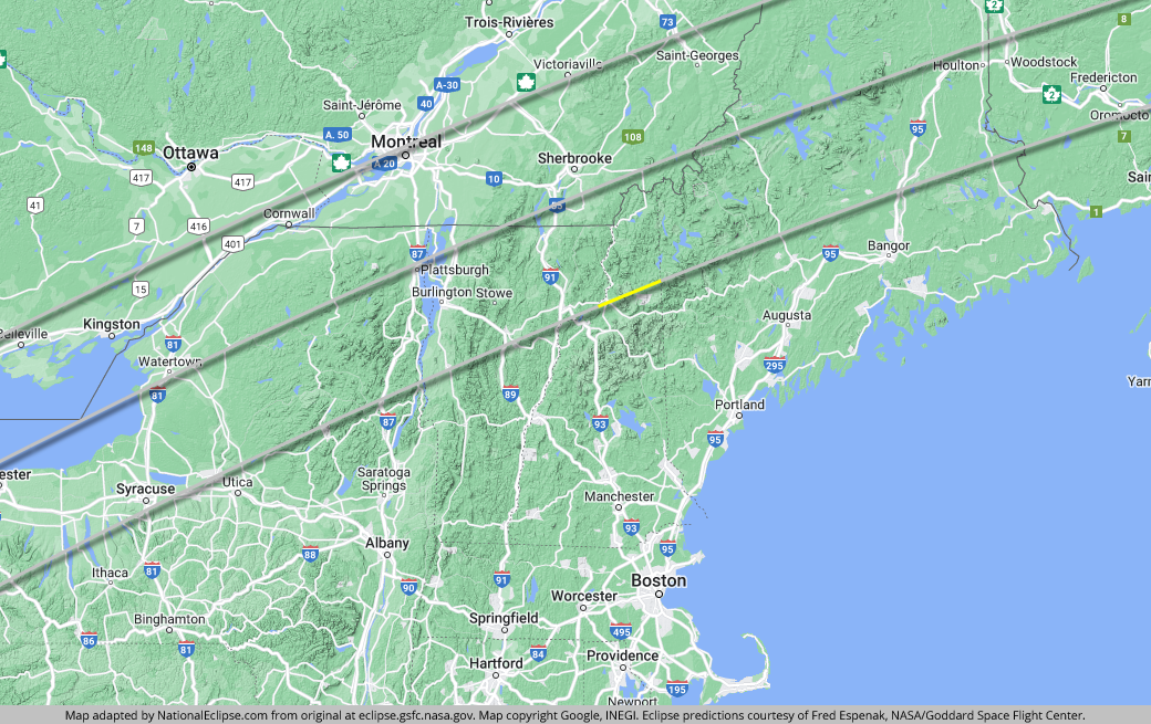
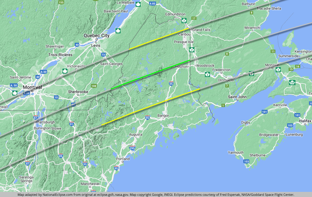
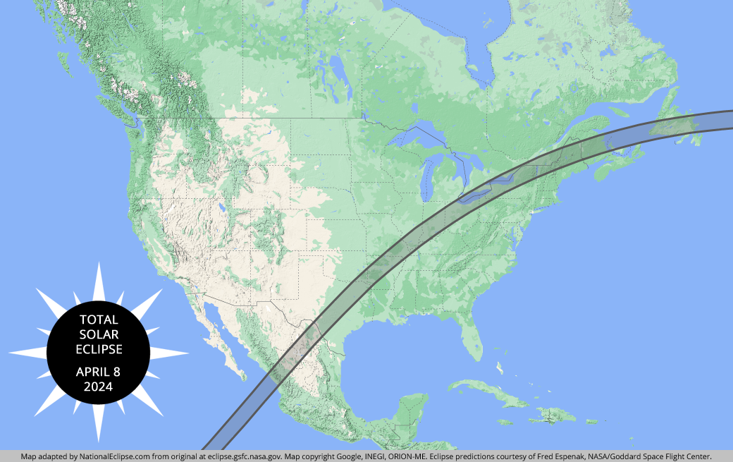
On April 8, 2024, a total solar eclipse traced a narrow path of totality across 13 U.S. states. A detailed map of each state along the path of totality can be found below. The yellow lines outline the limits of the path of totality in each state. The green middle line represents the eclipse centerline, where totality lasts the longest in each state. The grey lines show the path of totality entering and exiting each state.

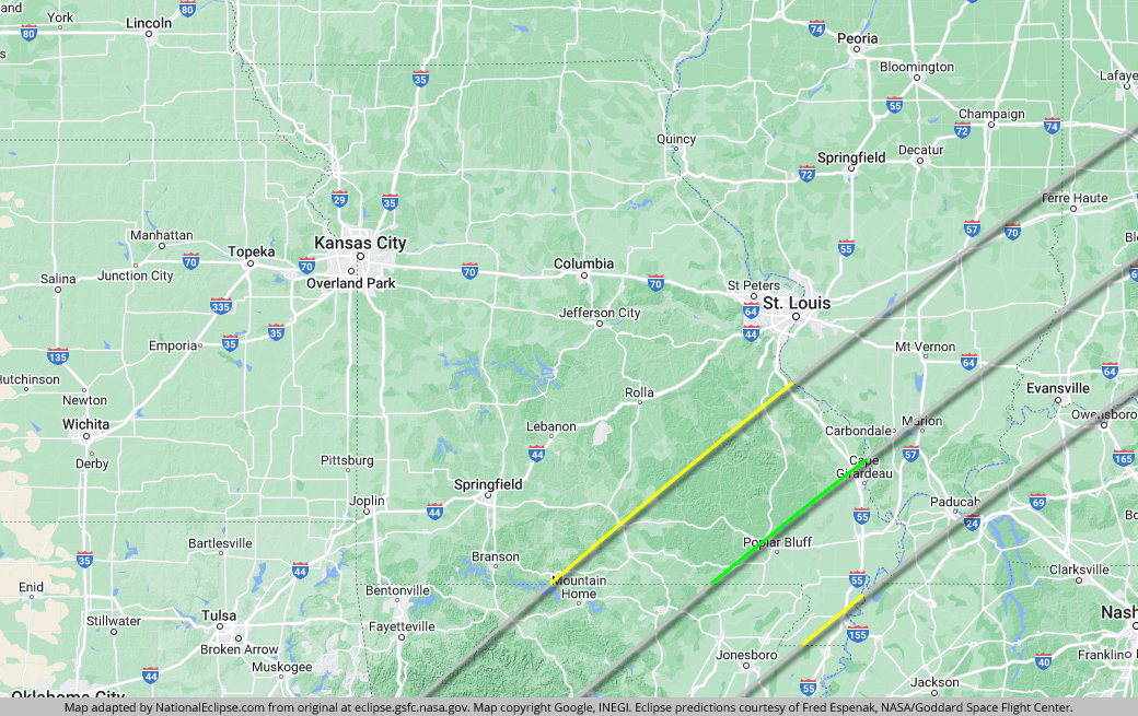
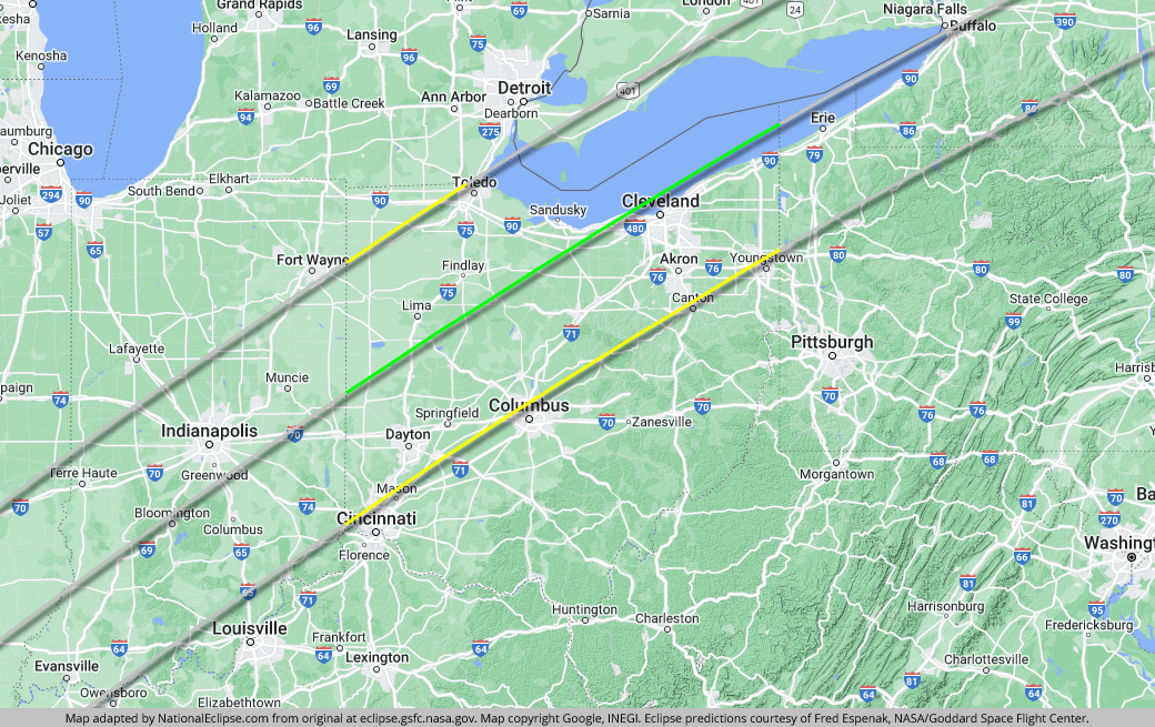
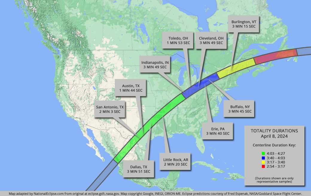
For the map below, note that times and durations can vary widely even within the same city and some cities are located only partially within the path of totality. All times and durations shown are only representative samples and should be used for general comparison purposes only.
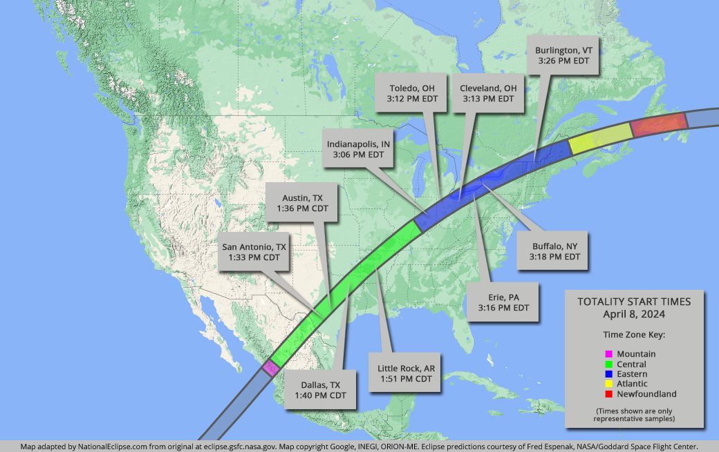
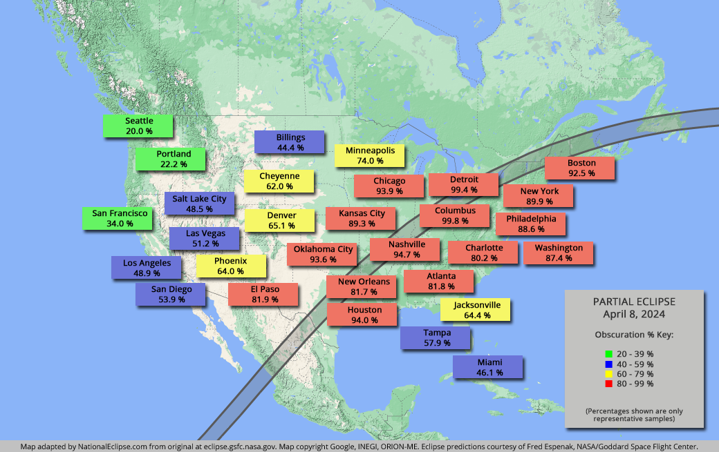
For the map below, note that times and durations can vary widely even within the same city and some cities are located only partially within the path of totality. All times and durations shown are only representative samples and should be used for general comparison purposes only.